Byron Bay is a beachside town located in the far-northeastern corner of the state of New South Wales, Australia. It is located 772 kilometres (480 mi) north of Sydney and 165 kilometres (103 mi) south of Brisbane. Cape Byron, a headland adjacent to the town, is the easternmost point of mainland Australia. At the 2006 Census, the town had a permanent population of 4,981. The town is in turn the nucleus of Byron Shire, which has in excess of 28,000 residents. The local Arakwal Aboriginal people's name for the area is Cavvanbah, meaning "meeting place".[3] Lieutenant James Cook named Cape Byron after John Byron, circumnavigator of the world and grandfather of the poet Lord Byron.
Showing posts with label Australia. Show all posts
Bondi Beach, Sydney, Australia
Saturday, March 22, 2014
.jpg)
Bondi Beach or Bondi Bay (/ˈbɒndaɪ/ BON-dye) is a popular beach and the name of the surrounding suburb in Sydney, New South Wales, Australia. Bondi Beach is located 7 km (4 mi) east of the Sydney central business district, in the local government area of Waverley Council, in the Eastern Suburbs. Bondi, North Bondi and Bondi Junction are neighbouring suburbs.
"Bondi" or "Boondi" is an Aboriginal word meaning water breaking over rocks or noise of water breaking over rocks. The Australian Museum records that Bondi means place where a flight of nullas took place.
.jpg)
.jpg)
.jpg)
.jpg)
In 1809, the road builder William Roberts received a grant of land in the area. In 1851, Edward Smith Hall and Francis O'Brien purchased 200 acres (0.81 km2) of the Bondi area that included most of the beach frontage, which was named the "The Bondi Estate." Hall was O'Brien's father-in-law. Between 1855 and 1877 O'Brien purchased his father-in-law's share of the land, renamed the land the "O'Brien Estate," and made the beach and the surrounding land available to the public as a picnic ground and amusement resort. As the beach became increasingly popular, O'Brien threatened to stop public beach access. However, the Municipal Council believed that the Government needed to intervene to make the beach a public reserve. On 9 June 1882, the Bondi Beach became a public beach.
.jpg)
.jpg)
.jpg)
.jpg)
Bondi Beach is about 1 kilometre (0.62 mi) long and receives many visitors throughout the year. Surf Life Saving Australia has given different hazard ratings to Bondi Beach in 2004. While the northern end has been rated a gentle 4 (with 10 as the most hazardous), the southern side is rated as a 7 due to a famous rip current known as the "Backpackers' Express" because of its proximity to the bus stop, and the unwillingness of tourists to walk the length of the beach to safer swimming. The south end of the beach is generally reserved for surfboard riding. Yellow and red flags define safe swimming areas, and visitors are advised to swim between them.
.jpg)
.jpg)
.jpg)
.jpg)
There is an underwater shark net shared, during the summer months, with other beaches along the southern part of the coast. Pods of whales and dolphins have been sighted in the bay during the months of migration. Fairy penguins, while uncommon, are sometimes also seen swimming close to shore or amongst surfers in southern line-up.
.jpg)
.jpg)
.jpg)
.jpg)
In 2007, the Guinness World Record for the largest swimsuit photo shoot was set at Bondi Beach, with 1,010 women wearing bikinis taking part. Bondi Beach was added to the Australian National Heritage List in 2008.
.jpg)
Labels:
Australia
,
Bondi Beach
,
Sydney
Margaret River, Australia
Sunday, February 23, 2014
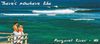
Margaret River is a town in the South West of Western Australia, located in the valley of the eponymous Margaret River, 277 kilometres (172 mi) south of Perth, the state capital. Its Local Government Area is the Shire of Augusta-Margaret River.


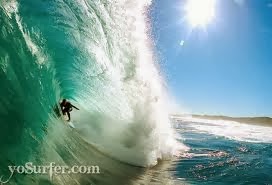
Margaret River's coast to the west of the town is a renowned surfing location, with world wide notoriety for its surf breaks. Colloquially, the area is referred to as Margs.
The surrounding area is the Margaret River Wine Region and is known for its wine production and tourism, attracting an estimated 500,000 visitors annually. In earlier days the area was better known for hardwood timber and agricultural production.


Margaret River is located 9 kilometres (6 mi) inland from the Indian Ocean at a point about halfway between Cape Naturaliste and Cape Leeuwin in Western Australia's South West region.


The town is named after the river, which is presumed to be named after Margaret Whicher, cousin of John Garrett Bussell (founder of Busselton) in 1831. The name is first shown on a map of the region published in 1839. European migrants lived in the area as early as 1850, with timber logging commencing in around 1870. By 1910, the town had a hotel which also operated as a post office.


The Margaret River area has acquired a range of synonyms for the collection of surf breaks nearby . Usually significant surfing competitions concentrate their locale to Margarets Main Break (aka Surfers Point) which breaks in the vicinity of Prevelly at the mouth of Margaret River.


The actual range of surf breaks range from the eastern side of Cape Naturaliste down to just south of Cape Hamelin, and despite web sites and online sources calling the whole Cape Naturaliste to Cape Leeuwin region the Margaret River surfing area, conditions and break types vary along the coast.
Several hundred caves are located near Margaret River, all of them within Leeuwin-Naturaliste National Park. Six of these are open to the public.

Subscribe to:
Posts
(
Atom
)